INDUSTRIES WE SERVE
Supporting Critical Projects Across Key Sectors
Geological and mapping services tailored to mining, infrastructure, land development, engineering, environmental, investment, public-sector, and natural resource sectors.
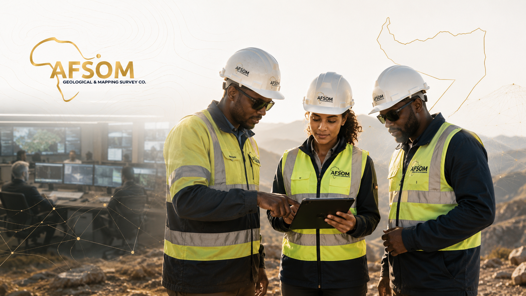
Every industry sector faces distinct geological and spatial data challenges. At AFSOM, we tailor our services to meet the specific technical requirements, regulatory expectations, and decision-making needs of each sector we serve. From grassroots mineral exploration to public-sector infrastructure planning, our team delivers fit-for-purpose solutions that help our clients move forward with confidence.
Mining and Mineral Exploration
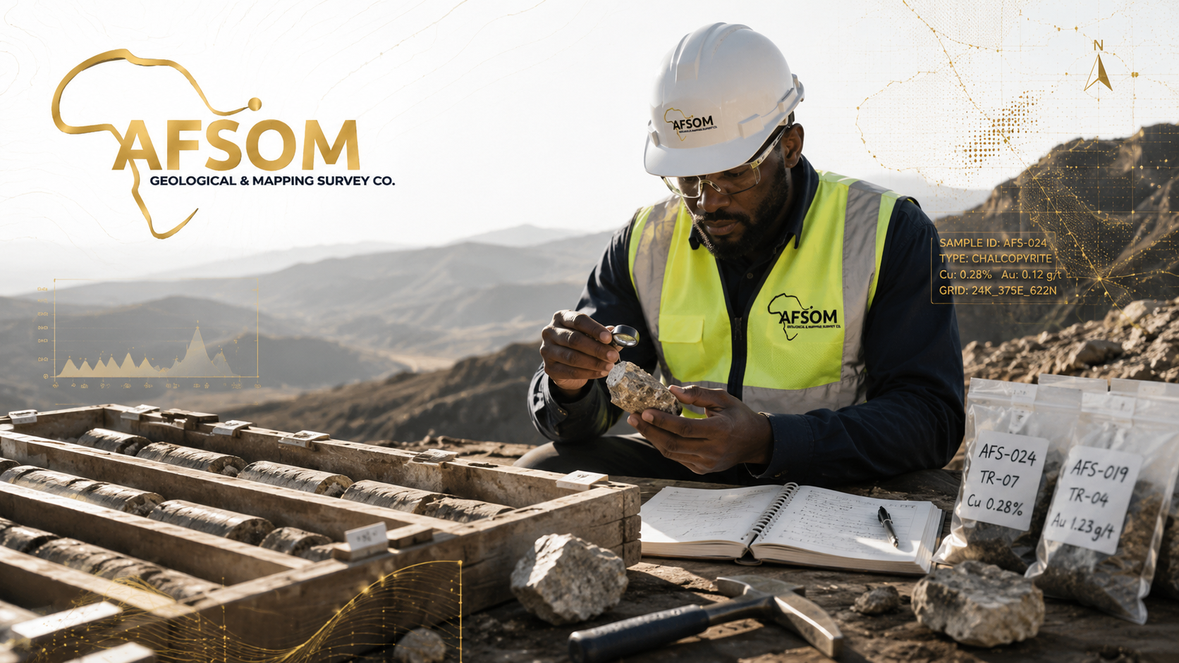
From early-stage target generation through to advanced resource drilling, AFSOM provides geological services that support every phase of the mineral exploration and mining lifecycle. Our work helps clients identify mineral potential, systematically evaluate deposits, and make informed development decisions.
Sector Challenge
Mineral exploration in underexplored regions requires building geological understanding from fundamentals with limited historical data. Companies face high technical risk, significant capital requirements, and the need to meet international reporting standards while operating in areas with limited existing infrastructure and geological information.
How AFSOM Supports
AFSOM provides end-to-end geological support for mining and exploration companies, from regional prospectivity assessments and target generation through to detailed mapping, sampling, drilling support, and resource evaluation. Our local geological expertise, systematic methodologies, and commitment to data quality help clients manage technical risk and make disciplined investment decisions at each stage of the exploration pipeline.
Relevant Services
Typical Deliverables
- Exploration program design and strategy documents
- Geological maps and cross-sections at prospect to deposit scale
- Geochemical sampling results and interpretation reports
- Drill hole geological logs and sampling databases
- Mineral resource estimation support documentation
- Technical reports compliant with international reporting codes
Infrastructure Development
Major infrastructure projects such as roads, railways, pipelines, dams, and power facilities require reliable geological and topographic information for route selection, foundation design, and construction planning. AFSOM provides the survey and mapping data that underpins sound engineering decisions.
Sector Challenge
Infrastructure projects in geologically complex or poorly documented terrain face significant risks including unexpected ground conditions, unstable slopes, aggressive soils, and construction material shortages. Inadequate site investigation and geological understanding during planning phases can lead to costly design changes, construction delays, and long-term performance issues.
How AFSOM Supports
AFSOM delivers geological and topographic surveys specifically designed to support infrastructure planning and design. Our services include route corridor mapping, engineering geological assessments, topographic surveys for earthwork design, construction material investigations, and terrain stability evaluations. We provide the geospatial and geological baseline that engineers and planners need to make informed technical decisions.
Relevant Services
Typical Deliverables
- Route corridor geological and topographic maps
- Engineering geological assessment reports
- Digital terrain models and contour maps
- Borrow material and aggregate investigation reports
- Slope stability and geohazard assessment documentation
- GIS databases with spatial data for engineering design integration
Land Development and Planning
Responsible land development depends on understanding terrain conditions, geological constraints, and environmental sensitivities. AFSOM provides survey and mapping services that support urban planning, agricultural development, and regional land-use management.
Sector Challenge
Land-use decisions made without adequate geological and topographic information can result in development in hazard-prone areas, inefficient infrastructure layouts, environmental degradation, and disputes over land suitability. Planning authorities and developers need objective spatial data to guide zoning, site selection, and development control.
How AFSOM Supports
AFSOM provides comprehensive terrain and geological assessments that inform land-use planning decisions. Our services include topographic mapping for site planning, geological hazard identification, land capability assessment, and environmental baseline mapping. We deliver digital GIS products that integrate seamlessly with planning systems and support evidence-based development decisions.
Relevant Services
Typical Deliverables
- Land capability and terrain assessment maps
- Geohazard identification and zonation maps
- Site suitability assessment reports
- Topographic base maps for planning overlay
- Environmental sensitivity and constraint maps
- GIS datasets for integration with planning information systems
Engineering Support
Engineering projects require precise survey control, accurate topographic data, and reliable ground information. AFSOM provides survey and geological services that form the essential geospatial foundation for civil, structural, and geotechnical engineering design.
Sector Challenge
Engineering design cannot proceed with confidence on unreliable or absent survey and ground-condition data. In many project areas, the lack of established survey control networks, up-to-date topographic plans, and subsurface geological information creates uncertainty that translates into conservative (and costly) designs, construction-phase surprises, and increased project risk.
How AFSOM Supports
AFSOM supports engineering projects with survey control establishment, detailed topographic surveys, as-built measurement, engineering geological assessments, and construction monitoring. Our survey data meets or exceeds engineering accuracy requirements, and our geological assessments provide the ground-condition information that geotechnical engineers need for foundation and earthworks design.
Relevant Services
Typical Deliverables
- Survey control network establishment report
- Detailed topographic survey plans and digital terrain models
- Volume calculation and earthworks quantity reports
- Engineering geological assessment and ground-condition report
- As-built survey documentation and verification reports
- Set-out data and construction survey support documentation
Environmental Assessment
Environmental impact assessments and management plans require robust baseline data on terrain, geology, soils, water resources, and land cover. AFSOM provides the geological and spatial data collection services that underpin credible environmental studies.
Sector Challenge
Environmental assessments are only as reliable as the baseline data they are built upon. In data-sparse regions, establishing credible environmental baselines for geology, soils, surface water, and land cover requires systematic field data collection and professional spatial analysis. Regulators increasingly expect high-quality, defensible environmental data to support permitting and compliance decisions.
How AFSOM Supports
AFSOM provides geological, soil, terrain, and land-cover mapping services that contribute to environmental baseline studies. Our remote sensing capabilities enable efficient land-cover classification and change detection, while our field survey services document geological and soil conditions. We deliver GIS-ready datasets that environmental consultants can integrate directly into impact assessment and management planning workflows.
Relevant Services
Typical Deliverables
- Baseline geological and soil condition maps
- Land-cover classification and vegetation mapping
- Surface water and drainage network maps
- Erosion and land degradation assessment reports
- Environmental constraint and sensitivity maps
- GIS datasets for integration with environmental impact assessments
Investment and Feasibility Studies
Sound investment decisions in the mineral and resource sectors depend on rigorous technical evaluation and independent assessment. AFSOM provides the geological and technical advisory services that support due diligence, feasibility analysis, and investment decision-making.
Sector Challenge
Investors and financial institutions need independent, technically competent assessments of mineral properties and resource projects to evaluate potential and manage risk. Without professional technical review, investment decisions may be based on incomplete or overly optimistic information, leading to capital misallocation and project failure.
How AFSOM Supports
AFSOM provides independent technical due diligence, property evaluations, mineral-potential assessments, and feasibility study support. Our consultants review geological data, assess exploration methodologies, evaluate resource potential, and provide clear, objective reports that help investors and financiers understand the technical merits and risks of mineral opportunities.
Relevant Services
Typical Deliverables
- Technical due-diligence reports with independent findings and recommendations
- Mineral-potential assessment reports for specific properties or regions
- Project valuation support documentation
- Risk assessment matrices with technical, operational, and regulatory factors
- Executive summary reports for investment committee review
- Feasibility study geology and resource sections
Public-Sector Projects
Government agencies and public institutions require reliable geological and mapping data to support national resource planning, infrastructure development, regulatory functions, and public safety. AFSOM provides survey and geological services tailored to public-sector requirements.
Sector Challenge
Public-sector organizations face the challenge of making policy, planning, and regulatory decisions across large geographic areas with limited geological and mapping data. National geological mapping programs, mineral resource assessments, hazard mapping, and infrastructure planning all require systematic, professional data collection that meets public accountability standards.
How AFSOM Supports
AFSOM partners with government agencies and public institutions to deliver geological surveys, mapping programs, resource assessments, and spatial data infrastructure development. We understand public-sector procurement, reporting, and accountability requirements, and we design our services to support policy objectives, regulatory functions, and public-good outcomes.
Relevant Services
Typical Deliverables
- Systematic geological map series at national to district scales
- Mineral resource and prospectivity assessments
- Geohazard identification and zonation maps
- National or regional spatial data infrastructure datasets
- Technical reports supporting policy development and regulatory functions
- Capacity-building documentation and knowledge-transfer materials
Natural Resource Development
Responsible development of natural resources including water, aggregates, construction materials, and energy resources requires geological assessment, resource quantification, and development planning. AFSOM provides the geological services that support sustainable resource management.
Sector Challenge
Natural resource development must balance economic objectives with environmental protection and social acceptance. Quantifying resource volumes, assessing quality, evaluating extraction feasibility, and planning sustainable development all depend on reliable geological data. In many regions, the absence of systematic resource assessments constrains development planning and informed resource management.
How AFSOM Supports
AFSOM provides geological surveys, resource assessments, and development planning support for a range of natural resources including groundwater, construction materials, industrial minerals, and dimension stone. Our services help clients and authorities understand resource distribution, quality, and development potential, supporting informed and sustainable resource management decisions.
Relevant Services
Typical Deliverables
- Resource assessment and estimation reports
- Geological and resource distribution maps
- Quarry and borrow-source evaluation reports
- Groundwater occurrence and potential assessment maps
- Resource development planning documentation
- GIS resource databases for ongoing management and monitoring
Need Geological Services for Your Sector?
Every industry has unique requirements. Contact us to discuss how AFSOM can tailor our services to your sector.