Land and Mineral Surveys
Professional land and mineral survey services including cadastral support, mineral investigations, area verification, target evaluation, and survey documentation. Supporting secure tenure and informed mineral asset decisions.
About Land and Mineral Surveys
Land and mineral surveys provide the legal, spatial, and geological information needed for mineral rights management, land-use planning, and resource development. AFSOM conducts cadastral support surveys, mineral occurrence investigations, area verification, and target evaluations that help clients establish tenure, assess potential, and make informed land-use decisions. Our survey documentation meets regulatory requirements and professional standards.
Key Service Areas:
- Land survey support
- Mineral investigations
- Area verification
- Target evaluation
- Survey documentation
The Challenge
Establishing secure land and mineral tenure, verifying area extents, and evaluating mineral potential require survey work that combines legal, spatial, and geological expertise. In regions where cadastral records are incomplete or disputed, and mineral occurrence data is sparse, organizations face elevated risk of boundary disputes, invalid tenure applications, and missed mineral opportunities. Professional survey support is essential to navigate these challenges.
Our Solution
AFSOM provides integrated land and mineral survey services that address both spatial-legal requirements and geological assessment needs. Our surveyors establish accurate boundaries and compile survey documentation for tenure applications, while our geologists investigate mineral occurrences and evaluate targets. This combined approach ensures that clients have reliable spatial information and geological context for their land and mineral assets.
What We Cover
Cadastral survey support including boundary demarcation, coordinate determination, and survey plan preparation
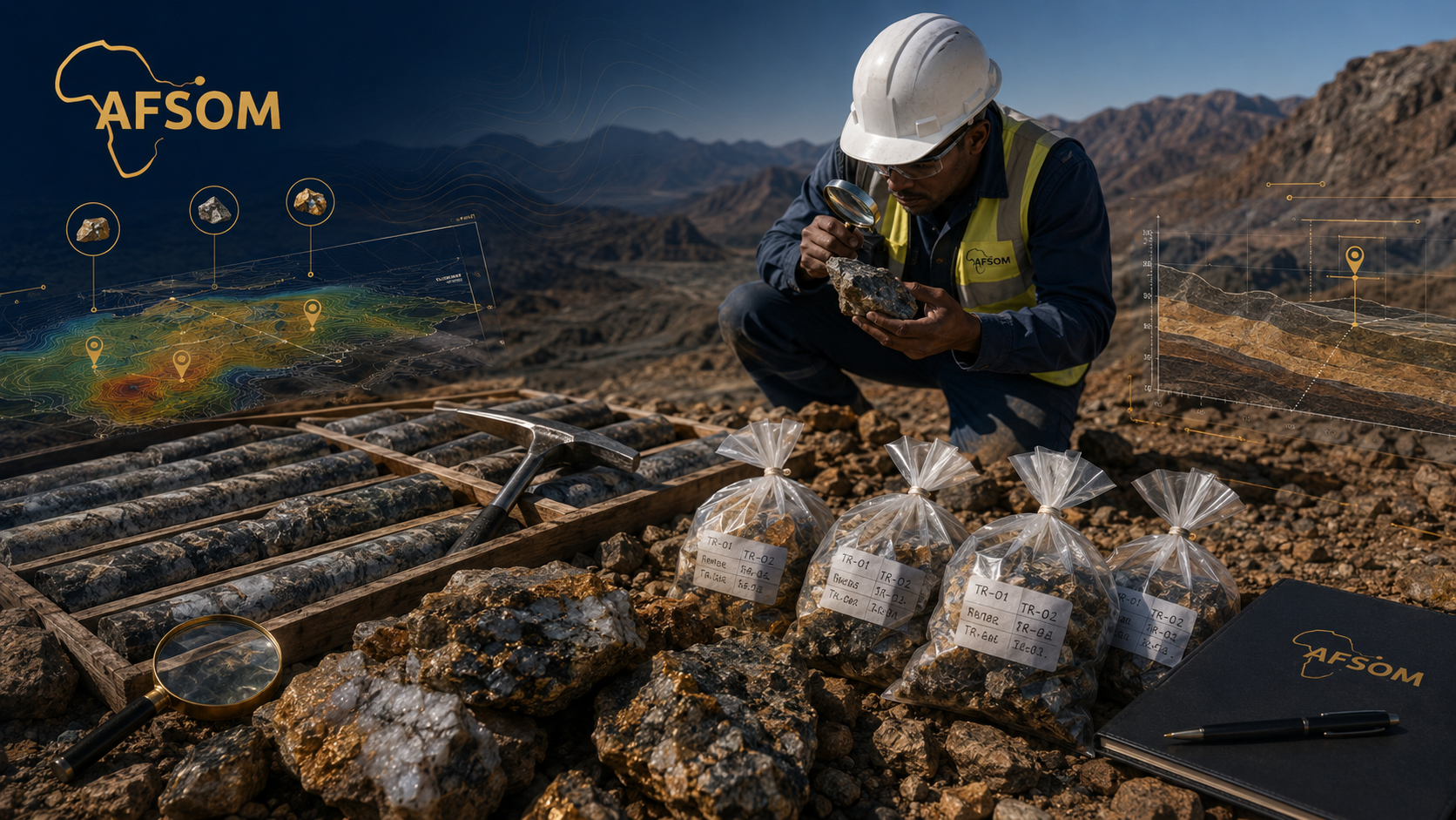
Mineral occurrence investigation through field examination, sampling, and preliminary assessment
Area verification surveys to confirm extent, accessibility, and physical characteristics of license areas
Target evaluation combining geological observations with remote sensing and geochemical data
Survey documentation preparation in accordance with applicable regulatory requirements
Land-use assessment identifying constraints, sensitivities, and development opportunities
How We Work
A structured approach delivering reliable results at every stage.
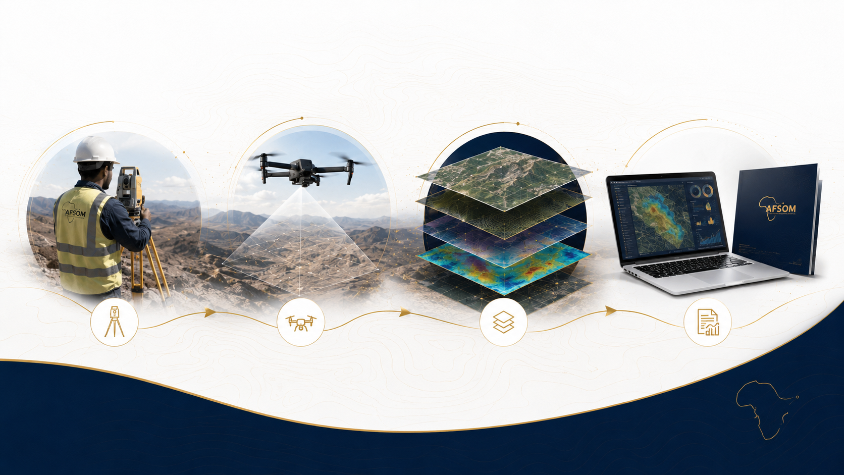
Desktop Review and Planning
We review cadastral records, license boundaries, geological data, and satellite imagery to plan the survey campaign.
Field Survey Execution
Survey and geology teams conduct boundary surveys, area verification, and mineral occurrence investigations according to planned traverses.
Data Processing and Analysis
Survey measurements are processed and adjusted, geological observations are interpreted, and findings are compiled.
Documentation and Reporting
Survey plans, mineral occurrence reports, and target evaluation documents are prepared to professional and regulatory standards.
Technology We Use
GNSS receivers and Total Stations
Accurate boundary surveys and coordinate determination with survey-grade precision.
GIS and mapping software
Spatial data management, boundary digitization, and survey plan production.
Geological field equipment
Rock and mineral identification, structural measurement, and sample collection.
Satellite imagery and aerial photography
Terrain assessment, access planning, and contextual mapping for area verification.
What You Receive
Survey plan and boundary description documentation for tenure applications
Mineral occurrence investigation report with field observations and preliminary assessment
Area verification report documenting site conditions, access, and land use
Target evaluation report with ranked priorities and recommendations for further work
GIS data layers with survey boundaries, observation points, and sample locations
Photographic documentation of key features, access conditions, and mineral occurrences
Why This Matters
Supports secure mineral and land tenure through accurate boundary surveys and documentation
Provides reliable information for investment decisions regarding mineral properties
Reduces risk of boundary disputes and tenure application rejection
Identifies mineral potential early, enabling efficient allocation of exploration resources
Combines legal, spatial, and geological information in a single coordinated service delivery
Discuss This Service
Ready to explore how land and mineral surveys can support your project? Get in touch with our team for a detailed discussion about your requirements.
We respond to all enquiries within two business days.