WHY CHOOSE AFSOM
The Right Partner. The Results.
Six compelling reasons why clients trust AFSOM for geological surveys, mapping, mineral exploration, and technical consultancy across Somaliland and the Horn of Africa.
Choosing the right geological and mapping partner is a critical decision that directly impacts project outcomes, investment confidence, and operational success. AFSOM combines regional expertise, modern technology, systematic methodology, and unwavering commitment to quality — delivering reliable results that clients can trust.
Six Reasons to Partner With Us
Each reason reflects a core strength that our clients value in every engagement.
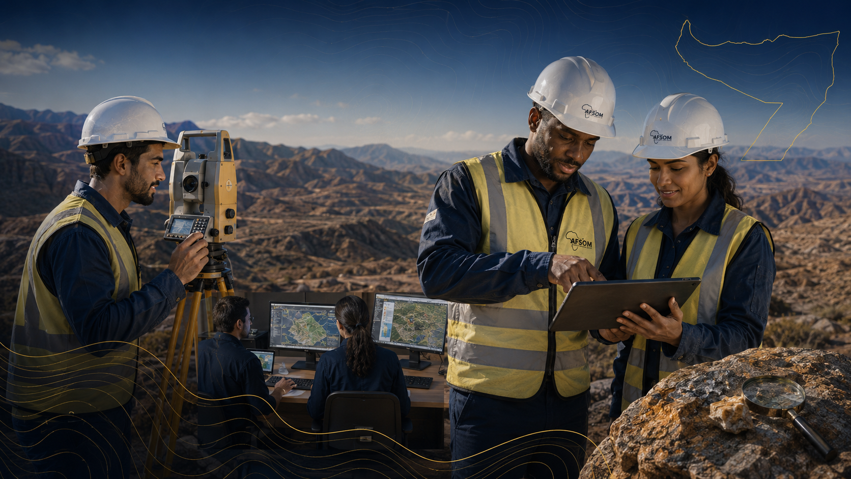
Experienced Professionals
Qualified geologists, surveyors, and GIS specialists with strong regional knowledge.
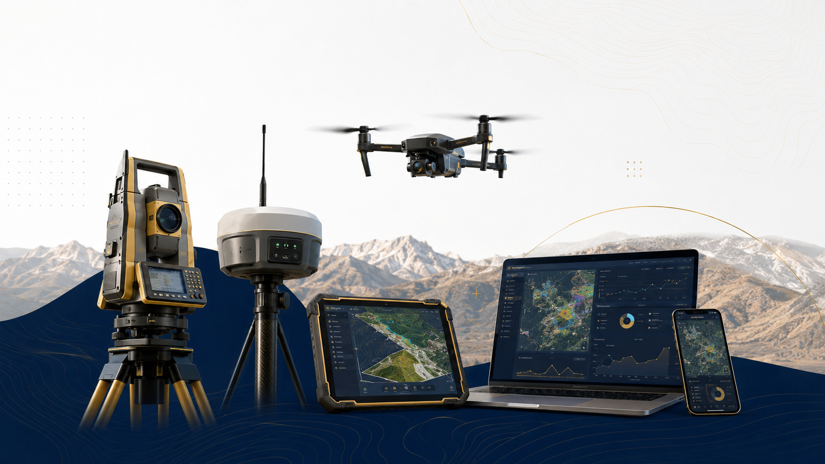
Advanced Technology
Modern surveying instruments, drones, satellite imagery, and GIS platforms.
Reliable Reporting
Thorough, well-structured technical reports you can trust for critical decisions.
Client-Focused Solutions
Every project is approached with the client's objectives and timeline in mind.
Quality and Integrity
Rigorous quality control and unwavering commitment to professional ethics.
Efficient Project Delivery
Streamlined workflows that deliver results on time without compromising quality.
From Data to Decision
How AFSOM transforms raw geological observations into the confident decisions that drive project success.
RAW FIELD DATA
Systematic geological observations, survey measurements, and sample results collected in the field using standardized protocols.
VERIFIED INFORMATION
Raw data is validated, processed, and quality-checked to produce reliable, analysis-ready datasets.
TECHNICAL INTERPRETATION
Experienced geologists interpret the validated data, integrating multiple data types to extract geological meaning and develop models.
ACTIONABLE INSIGHT
Technical interpretations are translated into clear findings, maps, and recommendations that are relevant to project objectives.
CONFIDENT DECISION
Clients receive the insight needed to make informed, confident decisions about exploration, investment, or development.
Capability You Can Rely On
Our team brings together qualified geologists, surveyors, GIS specialists, and technical professionals with deep regional knowledge of Somaliland and Horn of Africa geology. This combination of professional expertise and local understanding ensures that every project benefits from both technical rigour and practical field awareness.
We invest continuously in technology, training, and systems to maintain our capability at the forefront of professional practice. From modern survey instruments to advanced GIS platforms, our tools match our expertise — enabling us to deliver the quality and reliability our clients expect.
Local Expertise
Deep understanding of Somaliland and regional geology.
Advanced Technology
Modern surveying, GIS, and remote-sensing equipment.
Reliable Data
Systematic field collection and rigorous validation.
Professional Reporting
Clear, comprehensive technical documentation.
Client-Focused Delivery
Practical solutions aligned with project objectives.
Experience the AFSOM Difference
Partner with a team that combines regional expertise, modern technology, and a genuine commitment to your project's success.