GIS and Digital Mapping
Professional GIS services including geodatabase design, spatial data integration, data management, digital map production, spatial analysis, interactive dashboards, and thematic mapping. Data-driven insights for decision-making.
About GIS and Digital Mapping
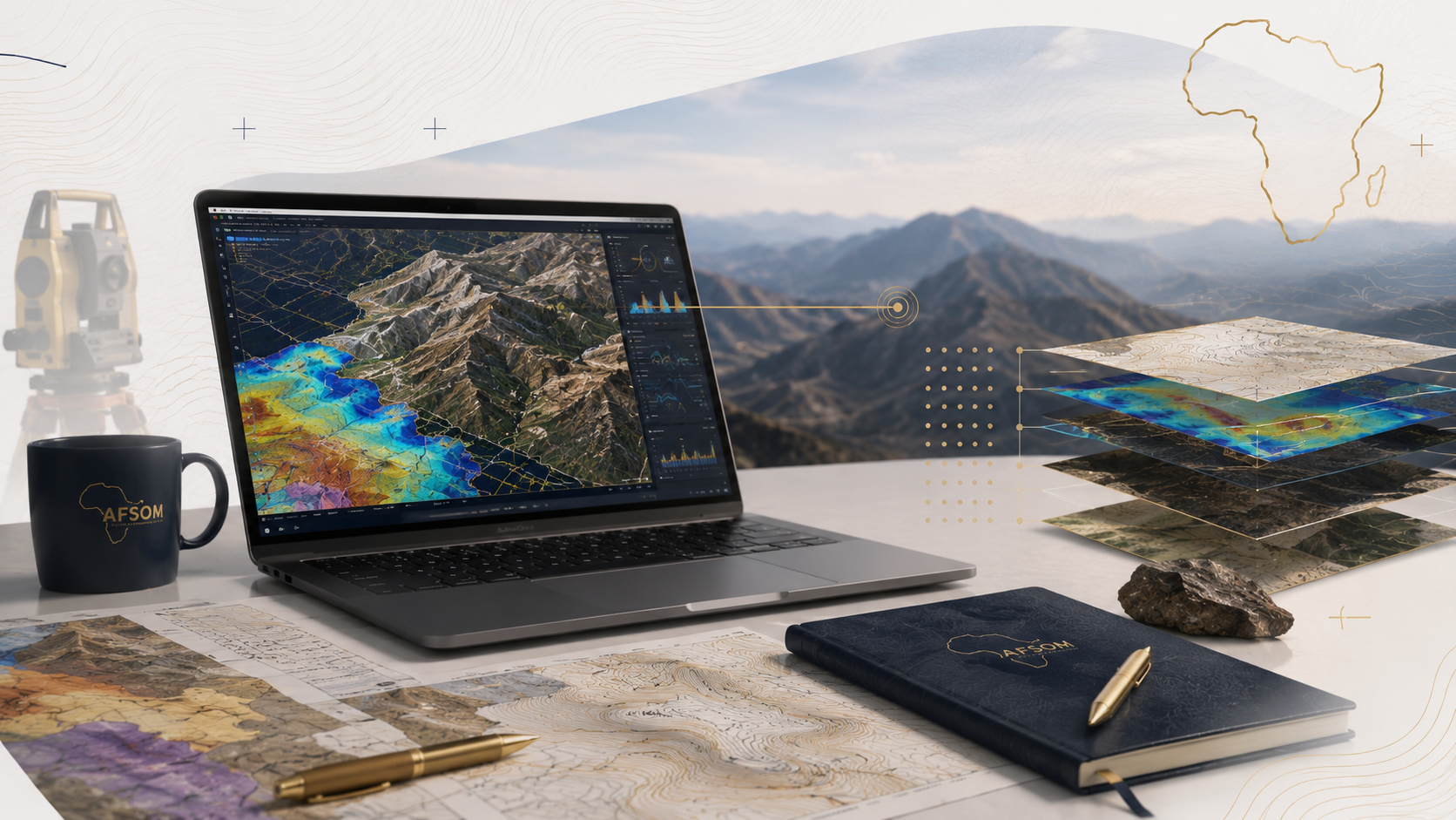
Geographic Information Systems transform raw spatial data into organized, queryable, and visually compelling information products. AFSOM designs and builds GIS databases, performs spatial analysis, and produces digital maps and dashboards that make geological and survey data accessible and actionable. Our GIS services ensure that project data is properly structured, documented, and maintained for ongoing use beyond the immediate project lifecycle.
Key Service Areas:
- GIS databases
- Spatial-data integration
- Data management
- Digital map production
- Spatial analysis
- Interactive dashboards
- Thematic maps
The Challenge
Geological and survey projects generate large volumes of spatial data in diverse formats from multiple sources. Without proper data management, this information becomes fragmented, difficult to access, and vulnerable to loss. Organizations struggle to integrate field observations, laboratory results, remote sensing data, and existing datasets into a coherent spatial framework that supports analysis and decision-making. Poor data management practices undermine the long-term value of project investments.
Our Solution
AFSOM provides comprehensive GIS and data management services that organize, integrate, and visualize spatial information. We design geodatabase schemas, implement data quality controls, perform spatial analyses, and produce professional digital maps and interactive dashboards. Our approach ensures that data is well-documented, easily retrievable, and structured to support both immediate project needs and long-term organizational knowledge management.
What We Cover
Design and implementation of GIS geodatabases with appropriate feature classes, attribute tables, and domains
Integration of field survey data, laboratory results, remote sensing interpretations, and existing datasets
Spatial data management including metadata creation, version control, and backup procedures
Digital map production with professional cartographic styling, legends, and coordinate systems
Spatial analysis including proximity, overlay, terrain, and statistical operations
Development of interactive dashboards for data visualization and query
Production of thematic maps highlighting specific geological, geochemical, or geophysical themes
GIS training and knowledge transfer to build client capacity for ongoing data use and maintenance
How We Work
A structured approach delivering reliable results at every stage.
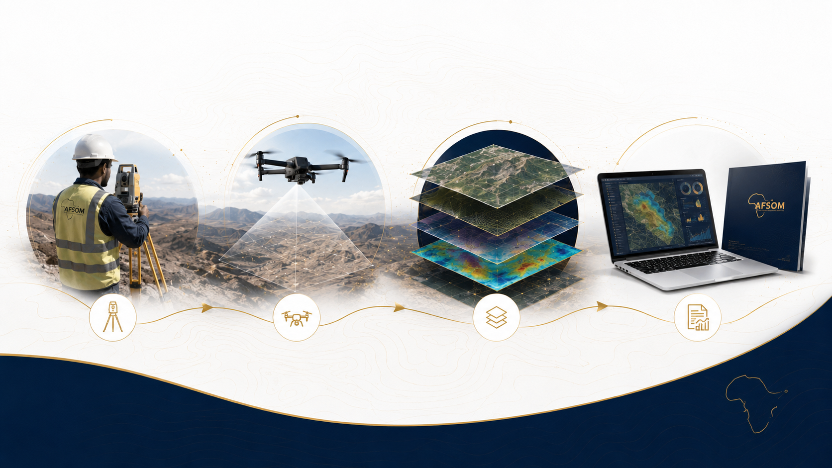
Requirements Analysis
We work with the client to define data types, spatial extents, coordinate systems, required analyses, and desired outputs.
Geodatabase Design
A logical and physical data model is designed with appropriate feature classes, attribute domains, relationship classes, and metadata structures.
Data Population and Validation
Field data, laboratory results, and external datasets are loaded into the geodatabase with quality checks for completeness, consistency, and spatial accuracy.
Spatial Analysis and Map Production
Analytical operations are performed to answer project questions, and results are communicated through thematic maps and dashboards.
Delivery and Handover
The geodatabase, maps, dashboards, and documentation are delivered with guidance on data maintenance and future use.
Technology We Use
Enterprise and desktop GIS platforms
Core GIS software for geodatabase management, spatial analysis, and cartographic production.
Spatial database systems
Robust data storage with support for spatial queries, multi-user access, and transaction management.
Dashboard and visualization tools
Interactive web-based dashboards for data exploration, filtering, and presentation.
Scripting and automation tools
Python-based geoprocessing for repetitive tasks, data validation, and custom analysis workflows.
Cloud GIS and data sharing platforms
Online map publishing and secure data sharing with project stakeholders.
What You Receive
GIS geodatabase with complete spatial data layers, attribute tables, and metadata documentation
Digital map series in PDF and image formats with professional cartographic styling
Interactive dashboard for data visualization, filtering, and query
Thematic map products addressing specific geological, geochemical, or project themes
Spatial analysis report with methodology description and interpretation of results
Data dictionary and metadata documentation for all delivered datasets
Why This Matters
Provides a single, organized repository for all project spatial data, preventing fragmentation and loss
Enables powerful spatial queries and analyses that reveal patterns and relationships in project data
Produces professional-quality maps and visualizations for reports, presentations, and stakeholder communication
Supports long-term data management, ensuring that project investments retain value over time
Facilitates data sharing and collaboration between project team members, clients, and regulators
Discuss This Service
Ready to explore how gis and digital mapping can support your project? Get in touch with our team for a detailed discussion about your requirements.
We respond to all enquiries within two business days.