Geological Survey Services
Professional geological survey services including field assessments, regional investigations, rock and soil sampling, structural observations, mineral occurrence identification, and geological interpretation. Systematic data collection for confident decisions.
About Geological Survey Services
Geological surveys form the foundation of informed decision-making in mining, infrastructure, and land development. AFSOM conducts systematic field-based geological assessments that document rock types, structures, mineral occurrences, and surficial materials. Our surveys provide the essential baseline data required for resource estimation, engineering design, environmental assessment, and exploration targeting. Each survey is tailored to the project's scale and objectives, ensuring that clients receive relevant, high-quality geological information.
Key Service Areas:
- Geological field assessments
- Regional geological investigations
- Rock and soil sampling
- Structural observations
- Mineral occurrence identification
- Geological interpretation
- Field data collection
The Challenge
Operating in regions with limited existing geological data creates significant uncertainty for project planners, investors, and developers. Without reliable baseline geology, organizations face increased risk of unexpected ground conditions, misallocated exploration budgets, poor siting decisions, and regulatory delays. In Somaliland and the Horn of Africa, the scarcity of published geological maps and datasets means that every project requires dedicated field investigation to establish a credible geological foundation.
Our Solution
AFSOM bridges the geological data gap by deploying qualified geologists to conduct rigorous field surveys using industry-standard methodologies. We systematically map, sample, and document geological features, then process and interpret the data to produce clear, actionable geological reports and maps. Our team's regional expertise ensures that field observations are placed in proper geological context, while our commitment to quality control guarantees reliable, defensible results.
What We Cover
Desktop review of existing geological literature, maps, and remote sensing data prior to field deployment
Field reconnaissance to establish geological context, access conditions, and key outcrop locations
Systematic rock and soil sampling following standardized protocols and chain-of-custody procedures
Structural measurements including bedding orientations, joint sets, fault characteristics, and fold geometry
Identification and documentation of mineral occurrences, alteration zones, and economic mineral indicators
Geological interpretation integrating field observations with regional tectonic and stratigraphic frameworks
Digital data capture using field tablets and GPS-enabled devices for seamless GIS integration
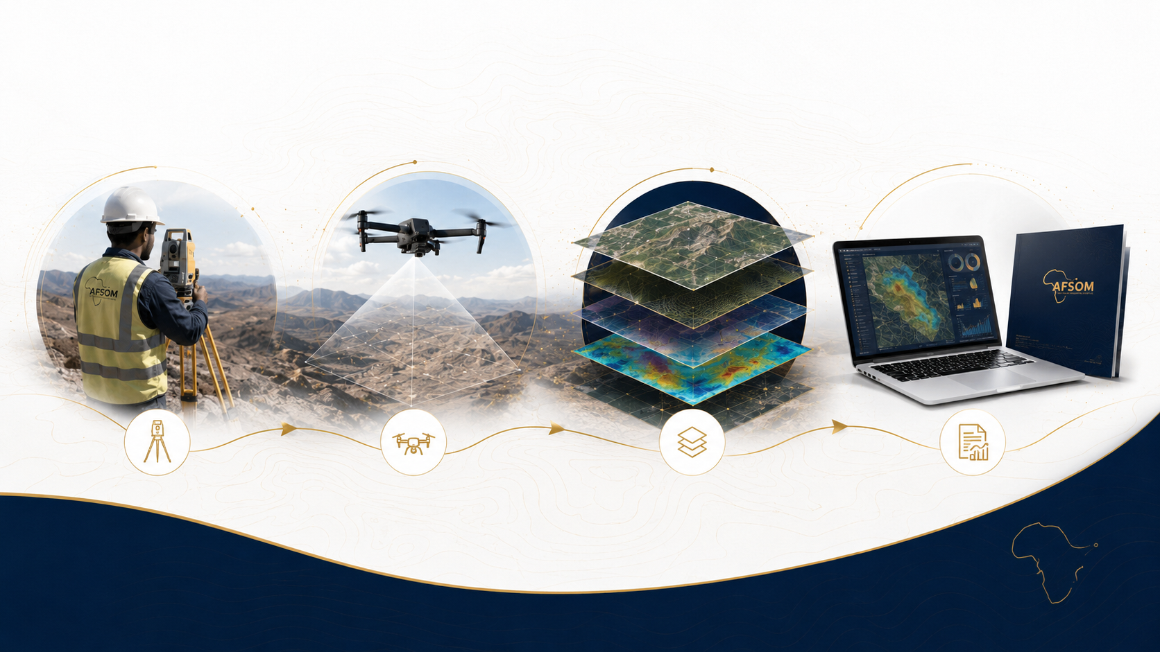
How We Work
A structured approach delivering reliable results at every stage.
Desktop Preparation
We review existing geological literature, satellite imagery, and available maps to establish the regional geological framework and plan field traverses.
Field Reconnaissance
A rapid initial survey identifies key outcrops, access routes, and logistical considerations that inform the detailed survey design.
Systematic Field Survey
Geologists traverse designated areas recording lithologies, structures, alteration, and mineralization using standardized field data sheets and digital capture tools.
Sampling Program
Rock and soil samples are collected, labeled, photographed, and dispatched to certified laboratories following strict chain-of-custody protocols.
Data Compilation and Reporting
Field observations are integrated with laboratory results and interpreted to produce geological maps, cross-sections, and comprehensive technical reports.
Technology We Use
Field tablets with mobile GIS
Real-time digital data capture with GPS-tagged observations and photo documentation.
Geological compass and clinometer
Precise measurement of planar and linear structural features in outcrop.
Handheld XRF analyzers
Rapid in-field geochemical screening of rocks and soils for element identification.
GPS and GNSS receivers
Accurate spatial positioning of observation points, sample locations, and traverse routes.
Satellite imagery and aerial photography
Pre-field planning, terrain assessment, and contextual mapping support.
What You Receive
Geological base map showing lithological units, structures, and observation points
Comprehensive geological survey report with detailed formation descriptions
Sample location register with GPS coordinates, field descriptions, and laboratory submission details
Structural measurement database with stereographic projection analysis
Mineral occurrence inventory with photographs and preliminary field assessment
Geological cross-sections illustrating subsurface structural and stratigraphic relationships
Digital GIS geodatabase with all field observations, sample data, and interpreted geology layers
Why This Matters
Establishes a reliable geological baseline that reduces project risk and uncertainty
Informs resource estimation, exploration targeting, and engineering design decisions
Supports regulatory compliance and environmental permitting applications
Identifies geological hazards such as fault zones, unstable slopes, and expansive soils
Provides a foundation for more detailed follow-up investigations and feasibility studies
Discuss This Service
Ready to explore how geological survey services can support your project? Get in touch with our team for a detailed discussion about your requirements.
We respond to all enquiries within two business days.