Remote Sensing
Professional remote sensing services including satellite imagery interpretation, drone survey support, land-cover analysis, change detection, geological structure analysis, target identification, and environmental mapping.
About Remote Sensing
Remote sensing provides a powerful synoptic perspective for geological assessment, environmental monitoring, and land-use analysis. AFSOM leverages satellite imagery, aerial photography, and UAV platforms to extract meaningful information about terrain, geology, vegetation, and surface conditions across scales ranging from regional reconnaissance to detailed site investigation. Our remote sensing services complement ground-based surveys, enabling more efficient targeting and broader contextual understanding.
Key Service Areas:
- Satellite imagery interpretation
- Drone survey support
- Land-cover analysis
- Change detection
- Geological structure analysis
- Target identification
- Environmental mapping
The Challenge
Ground-based geological and environmental surveys are essential but can be time-consuming and expensive, particularly for large or inaccessible areas. Organizations need efficient methods to prioritize field efforts, identify targets, and monitor change over time. Interpreting remote sensing data requires specialized expertise in image processing, spectral analysis, and geological feature recognition that may not be available within client organizations.
Our Solution
AFSOM applies professional remote sensing analysis techniques to extract geological, structural, and environmental information from satellite and aerial imagery. Our team processes multispectral and radar data to identify lithological boundaries, alteration patterns, structural lineaments, and land-cover changes. UAV-based surveys provide high-resolution imagery and terrain data for detailed site-scale mapping. We integrate remote sensing interpretations with field validation to produce reliable, ground-truthed products.
What We Cover
Multispectral satellite imagery acquisition, processing, and geological interpretation
Structural lineament extraction and analysis for regional tectonic and exploration targeting
Alteration mineral mapping using spectral indices and band ratio techniques
Land-cover classification and vegetation mapping for environmental baseline studies
Change detection analysis comparing multi-temporal imagery to identify surface modifications
UAV-based aerial survey planning, execution, and orthophoto production
Target identification and prioritization to guide ground-based exploration programs
Environmental mapping including surface water, erosion, and land degradation assessment
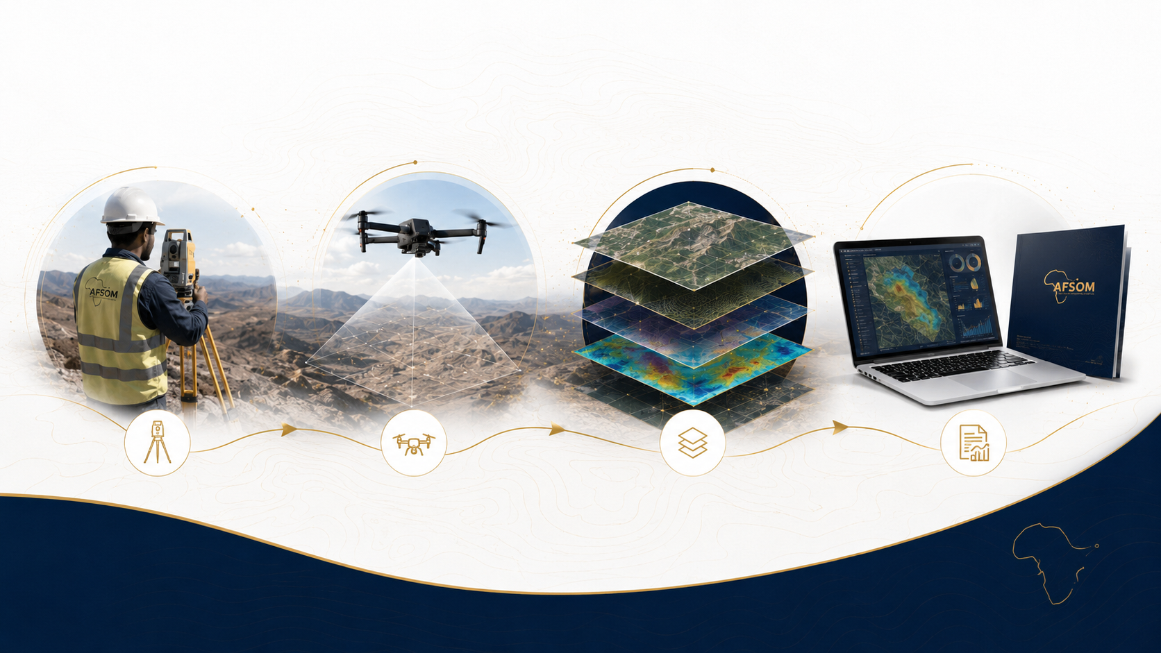
How We Work
A structured approach delivering reliable results at every stage.
Imagery Acquisition and Preprocessing
We source appropriate satellite imagery or plan UAV flights, then perform radiometric and geometric corrections to prepare data for analysis.
Interpretation and Classification
Imagery is systematically interpreted to identify geological features, structural patterns, alteration zones, and land-cover categories using visual and digital techniques.
Spatial Analysis and Extraction
Lineaments, spectral anomalies, and target areas are extracted as GIS layers for integration with other project datasets.
Field Validation
Key remote sensing interpretations are verified through targeted field checks to confirm accuracy and refine the analysis.
Final Product Compilation
Interpreted imagery, thematic maps, and target inventories are compiled into a comprehensive remote sensing report with GIS deliverables.
Technology We Use
Multispectral satellite platforms
Regional to local-scale imagery providing visible, near-infrared, and shortwave-infrared bands for geological analysis.
UAV with RGB and multispectral sensors
High-resolution aerial survey for detailed site mapping, orthophoto production, and terrain modelling.
Image processing and GIS software
Radiometric enhancement, band ratio calculation, classification, and spatial analysis workflows.
Digital elevation models
Topographic context for imagery interpretation, orthorectification, and terrain analysis.
Spectral analysis tools
Mineral identification and alteration mapping through spectral signature comparison and band math.
What You Receive
Remote sensing interpretation report describing methodology, findings, and recommendations
Image interpretation maps showing geological units, structural features, and alteration zones
Lineament and structural trend maps with statistical analysis of orientation distributions
Target inventory with ranked priorities, coordinates, and rationale for field investigation
Land-cover classification map for environmental baseline and change assessment
Orthophoto mosaics and digital surface models from UAV surveys
GIS geodatabase with all interpreted layers, image chips, and target attribute tables
Why This Matters
Covers large and inaccessible areas efficiently, reducing the cost and time of regional assessment
Identifies potential exploration targets before committing to expensive ground-based programs
Provides objective, repeatable environmental baseline data for monitoring and compliance
Enhances geological understanding by revealing regional-scale structures and patterns
Supports informed planning by integrating remote observations with ground-based validation
Discuss This Service
Ready to explore how remote sensing can support your project? Get in touch with our team for a detailed discussion about your requirements.
We respond to all enquiries within two business days.